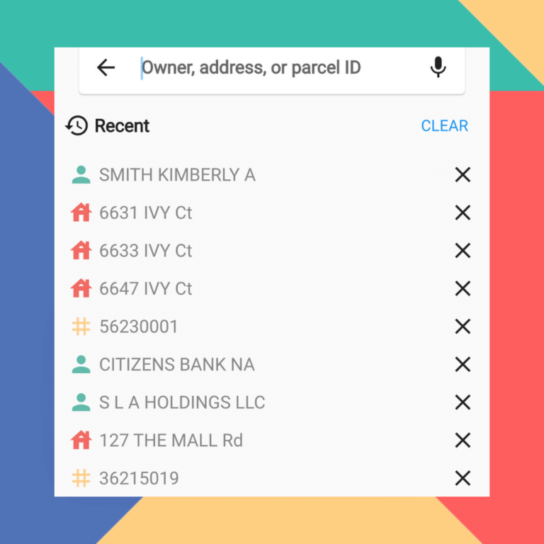
Finding Property On LandGlide Is Easier Than Ever
LandGlide, the most advanced and comprehensive parcel data and property line map application that gives you access on all your…
The smart choice for parcel data.
The smart choice for parcel data.
LandGlide, the most advanced and comprehensive parcel data and property line map application that gives you access on all your…

A look at unique ways our team uses LandGlide and how professionals use it in various industries. How Does The…
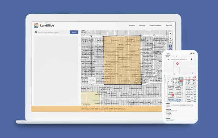
You Asked, We Listened – LandGlide® for the Web is Here! We’re excited to announce that the LandGlide® app you…

Have you ever wondered how Santa is able to make it to every house in one night? It’s not without careful planning or trusted partners, like ReportAll USA, Mother Nature and maybe a touch of magic.

ReportAll has the largest, most up-to date parcel polygon data layer, but did you know that we have several enriched layer attributes that can be used for unique geographical analyses? From elevation, flood zone types and more, we can help you find the answers you need.

ReportAll API Solution At ReportAll, we design each of our parcel data solutions to provide the best possible user experience…
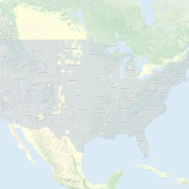
Sourcing reliable and up-to-date national parcel data can be a daunting task. Which provider has the best coverage? Does this…

Empower Your Industry With Our Updated Parcel Data App At ReportAll, we understand the desire to interact with technology that…

Free isn’t free when comparing property data sets from multiple counties or parishes “Data wants to be free” was an early…

New DroneGlide™ Fence software is the answer to keeping your drone safely within your own property lines. The stories are out there…